

Greeley topographic map
Click on the map to display elevation.
Greeley
Greeley experiences a semi-arid climate (Köppen BSk). High temperatures are generally around 90–95 °F (32 °C) in the summer and 40-45 °F (4 °C) in the winter, although significant variation occurs. The hottest days generally occur around the third week of July and the coldest in January. Nighttime lows are near 60 °F (16 °C) in the summer and around 15–20 °F (−9 °C) in the winter. Record high temperatures of 112 °F (44.4 °C) have been recorded, as have record low temperatures of –25 °F (–32 °C). The first freeze typically occurs around October 4 and the last around May 4. Extratropical cyclones which disrupt the weather for the eastern two-thirds of the US often originate in or near Colorado, which means Greeley does not experience many fully developed storm systems. Warm fronts, sleet, and freezing rain are practically nonexistent here. In addition, the city's proximity to the Rocky Mountains and lower elevation, compared to the mountains west of the city, result in less precipitation and fewer thunderstorms. This is paradoxical, because adjacent areas (mostly farmland) experience between 7 and 9 hail days per year.
About this map
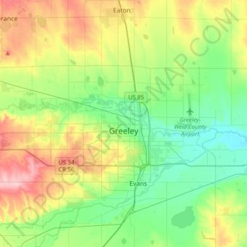
Name: Greeley topographic map, elevation, terrain.
Location: Greeley, Weld County, Colorado, United States (40.37757 -104.90739 40.48122 -104.61914)
Average elevation: 1,448 m
Minimum elevation: 1,398 m
Maximum elevation: 1,543 m