
Elkford topographic map
Interactive map
Click on the map to display elevation.
About this map
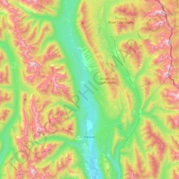
Name: Elkford topographic map, elevation, terrain.
Average elevation: 1,895 m
Minimum elevation: 1,228 m
Maximum elevation: 2,905 m
Other topographic maps
Click on a map to view its topography, its elevation and its terrain.
Area A (Upper Flathead/Elk Valley)
Kanada > Britisch-Kolumbien > Regional District of East Kootenay
Area A (Upper Flathead/Elk Valley), Regional District of East Kootenay, Britisch-Kolumbien, Kanada
Average elevation: 1,578 m
Kimberley
Kanada > Britisch-Kolumbien > Regional District of East Kootenay
Kimberley, Regional District of East Kootenay, Britisch-Kolumbien, Kanada
Average elevation: 1,216 m