Geolocate

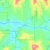
Morganton topographic map

Click on the map to display elevation.

About this map
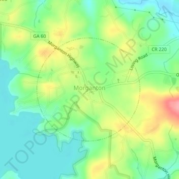
Name: Morganton topographic map, elevation, terrain.

Location: Morganton, Fannin County, Georgia, United States (34.86767 -84.25304 34.88221 -84.23538)

Average elevation: 538 m

Minimum elevation: 499 m

Maximum elevation: 602 m

Other topographic maps

Click on a map to view its topography, its elevation and its terrain.

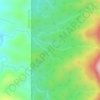
Aska

United States > Georgia > Fannin County

Average elevation: 629 m

Dial

United States > Georgia > Fannin County

Average elevation: 612 m

Wilscot

United States > Georgia > Fannin County

Average elevation: 614 m

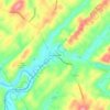
Brown Mill

United States > Georgia > Fannin County

Average elevation: 543 m

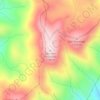
Springer Mountain

United States > Georgia > Fannin County

Springer Mountain is a mountain located in the Chattahoochee National Forest on the border of Fannin and Gilmer counties. Located in the Blue Ridge Mountains in northern Georgia, the mountain has an elevation of about 3,782 feet (1,153 m). Springer Mountain serves as the southern terminus for the Appalachian…

Average elevation: 941 m
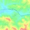
Union

United States > Georgia > Fannin County

Average elevation: 517 m

Hemp

United States > Georgia > Fannin County

Average elevation: 587 m

Kingtown

United States > Georgia > Fannin County > McCaysville

Average elevation: 489 m

Mineral Bluff

United States > Georgia > Fannin County

Average elevation: 516 m

Springer Mountain

United States > Georgia > Fannin County

Springer Mountain is a mountain located in the Chattahoochee National Forest on the border of Fannin and Gilmer counties. Located in the Blue Ridge Mountains in northern Georgia, the mountain has an elevation of about 3,770 feet (1,149 m). Springer Mountain serves as the southern terminus for the Appalachian…

Average elevation: 941 m

Lakewood

United States > Georgia > Fannin County

Average elevation: 526 m

Hemp

United States > Georgia > Fannin County

Average elevation: 587 m

Margret

United States > Georgia > Fannin County

Average elevation: 683 m

Epworth

United States > Georgia > Fannin County

Average elevation: 524 m

Forge Mill

United States > Georgia > Fannin County

Average elevation: 537 m

Curtis

United States > Georgia > Fannin County

Average elevation: 503 m

McCullough

United States > Georgia > Fannin County

Average elevation: 559 m

Pleasant Hill

United States > Georgia > Fannin County

Average elevation: 547 m

Gear up for your next adventure:

🩹Wilderness First Aid Kits - Comprehensive medical kits tailored for hiking and remote exploration
🧣Merino Neck Gaiters - Versatile headwear for warmth, sun protection, or dust filtering
🕶️Polarized Outdoor Sunglasses - Reduce glare from rocks and water for better visual navigation
🧼Biodegradable Soap - Eco-friendly outdoor soap
🪢Paracord - Multi-purpose survival cord

As an Amazon Associate, this site earns from qualifying purchases at no extra cost to you.