
Thank you for supporting this site ❤️
Make a donation
Make a donation
Gear up for your next adventure:
As an Amazon Associate, this site earns from qualifying purchases at no extra cost to you.
Rinegg topographic map
Click on the map to display elevation.
Thank you for supporting this site ❤️
Make a donation
Make a donation
Gear up for your next adventure:
As an Amazon Associate, this site earns from qualifying purchases at no extra cost to you.
About this map
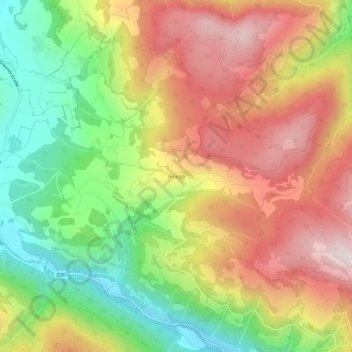
Name: Rinegg topographic map, elevation, terrain.
Location: Rinegg, Ranten, Bezirk Murau, Styria, 8853, Austria (47.13592 14.12400 47.17592 14.16400)
Average elevation: 1,196 m
Minimum elevation: 854 m
Maximum elevation: 1,542 m
Thank you for supporting this site ❤️
Make a donation
Make a donation
Gear up for your next adventure:
As an Amazon Associate, this site earns from qualifying purchases at no extra cost to you.