
后里區 topographic map
Interactive map
Click on the map to display elevation.
About this map
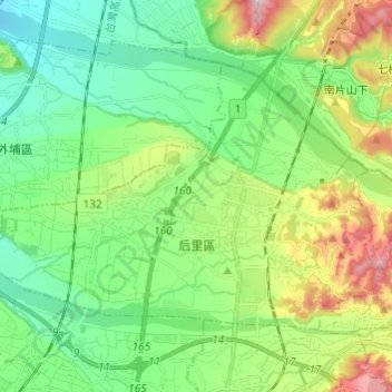
Name: 后里區 topographic map, elevation, terrain.
Location: 后里區, Taichung, Taïwan (24.28064 120.64634 24.35583 120.76749)
Average elevation: 225 m
Minimum elevation: 73 m
Maximum elevation: 558 m
Other topographic maps
Click on a map to view its topography, its elevation and its terrain.