
Blackdown topographic map
Interactive map
Click on the map to display elevation.
Blackdown
Because of its elevation, from 1796 to 1816 Blackdown hosted a station in the shutter telegraph chain which quickly linked the Admiralty in London to its naval ships in Portsmouth.
About this map
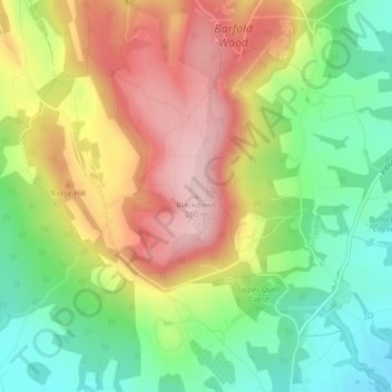
Name: Blackdown topographic map, elevation, terrain.
Average elevation: 165 m
Minimum elevation: 63 m
Maximum elevation: 280 m
Other topographic maps
Click on a map to view its topography, its elevation and its terrain.