Geolocate

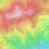
Riolunato topographic map

Click on the map to display elevation.

About this map

Name: Riolunato topographic map, elevation, terrain.

Location: Riolunato, Unione dei comuni del Frignano, Modena, Emilia-Romagna, 41020, Italy (44.19449 10.58605 44.27479 10.71438)

Average elevation: 1,118 m

Minimum elevation: 529 m

Maximum elevation: 2,153 m

Other topographic maps

Click on a map to view its topography, its elevation and its terrain.
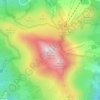
Monte Cimone

Italy > Emilia-Romagna > Modena > Fiumalbo

The mountain has an elevation of 2,165 m and is also the highest point in the Emilia-Romagna region of Italy.

Average elevation: 1,759 m
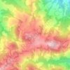
Montombraro

Italy > Emilia-Romagna > Modena

Average elevation: 566 m

Galleria

Italy > Emilia-Romagna > Modena > Campogalliano

Average elevation: 40 m

Barigazzo

Italy > Emilia-Romagna > Modena

Average elevation: 1,170 m

Monte della Torraccia

Italy > Emilia-Romagna > Modena > Montese

Average elevation: 923 m

Pianorso

Italy > Emilia-Romagna > Modena

Average elevation: 846 m

Villanova

Italy > Emilia-Romagna > Modena > Modena

Average elevation: 32 m

Gear up for your next adventure:

🎒3L Hydration Reservoirs - Hands-free drinking to stay hydrated on steep contour climbs
🎒40L Day Hiking Backpacks - Comfortable packs with hydration support for long days exploring topographic peaks
🔪Outdoor Multi-tools - Versatile tools for gear repair and survival tasks in the wilderness
🔑Heavy Duty Carabiners - Secure gear to the outside of your pack for easy access
🧭Global Orienteering Compass - High-precision liquid-filled compasses for accurate map reading and navigation

As an Amazon Associate, this site earns from qualifying purchases at no extra cost to you.