Geolocate

Menston topographic map

Click on the map to display elevation.

About this map

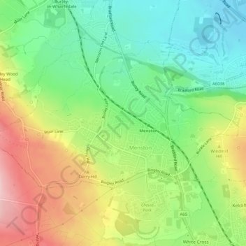
Name: Menston topographic map, elevation, terrain.

Location: Menston, Bradford, West Yorkshire, England, United Kingdom (53.88469 -1.76729 53.90059 -1.71705)

Average elevation: 137 m

Minimum elevation: 55 m

Maximum elevation: 254 m

Other topographic maps

Click on a map to view its topography, its elevation and its terrain.

Derry Hill

United Kingdom > England > Bradford > Menston

Average elevation: 174 m

Gear up for your next adventure:

🛌Sleeping Mats - Insulated mats for camping comfort
🎒Dry Bags - Waterproof bags for outdoor gear
🔪Camping Knives - Multi-purpose outdoor knives
🎒Hiking Backpacks - Backpacks designed for hiking and trekking
🧢Outdoor Sun Hats - Sun protection hats for hiking

As an Amazon Associate, this site earns from qualifying purchases at no extra cost to you.