
Thank you for supporting this site ❤️
Make a donation
Make a donation
Gear up for your next adventure:
As an Amazon Associate, this site earns from qualifying purchases at no extra cost to you.
Baghlia topographic map
Click on the map to display elevation.
Thank you for supporting this site ❤️
Make a donation
Make a donation
Gear up for your next adventure:
As an Amazon Associate, this site earns from qualifying purchases at no extra cost to you.
About this map
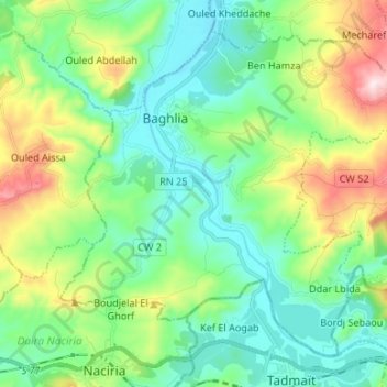
Name: Baghlia topographic map, elevation, terrain.
Location: Baghlia, Baghlia District, Boumerdes, 35055, Algeria (36.75120 3.82154 36.84092 3.95469)
Average elevation: 152 m
Minimum elevation: 1 m
Maximum elevation: 546 m
Thank you for supporting this site ❤️
Make a donation
Make a donation
Gear up for your next adventure:
As an Amazon Associate, this site earns from qualifying purchases at no extra cost to you.