Geolocate

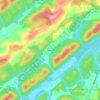
Maynardville topographic map

Click on the map to display elevation.

About this map

Name: Maynardville topographic map, elevation, terrain.

Location: Maynardville, Union County, East Tennessee, Tennessee, 37807, United States (36.22456 -83.84809 36.26760 -83.76713)

Average elevation: 408 m

Minimum elevation: 318 m

Maximum elevation: 541 m

Other topographic maps

Click on a map to view its topography, its elevation and its terrain.

Sharps Chapel

United States > Tennessee > Union County

Average elevation: 362 m

Braden

United States > Tennessee > Union County

Average elevation: 383 m

Beulah

United States > Tennessee > Union County

Average elevation: 336 m

Paulette

United States > Tennessee > Union County

Average elevation: 337 m

Gear up for your next adventure:

🦟Heavy Duty Insect Repellent - Essential protection against flies, mozzies, and march flies
🔥Ferrocerium Rod Fire Starters - Reliable fire lighting in wet or windy conditions without matches
💧Personal Water Filters - Drink safely from streams and lakes identified on your map
🔭Compact Hiking Binoculars - Lightweight optics for scouting routes or birdwatching
🛌Sleeping Mats - Insulated mats for camping comfort

As an Amazon Associate, this site earns from qualifying purchases at no extra cost to you.