
Glen Allen topographic map
Interactive map
Click on the map to display elevation.
About this map
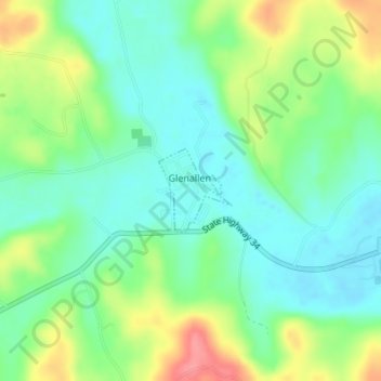
Name: Glen Allen topographic map, elevation, terrain.
Location: Glen Allen, Bollinger County, Missouri, United States (37.31400 -90.03065 37.31991 -90.02407)
Average elevation: 160 m
Minimum elevation: 132 m
Maximum elevation: 212 m
Other topographic maps
Click on a map to view its topography, its elevation and its terrain.
Glenallen
United States > Missouri > Bollinger County > Glen Allen
Glenallen, Glen Allen, Bollinger County, Missouri, United States
Average elevation: 166 m