
Thank you for supporting this site ❤️
Make a donation
Make a donation
Gear up for your next adventure:
As an Amazon Associate, this site earns from qualifying purchases at no extra cost to you.
Winkel topographic map
Click on the map to display elevation.
Thank you for supporting this site ❤️
Make a donation
Make a donation
Gear up for your next adventure:
As an Amazon Associate, this site earns from qualifying purchases at no extra cost to you.
About this map
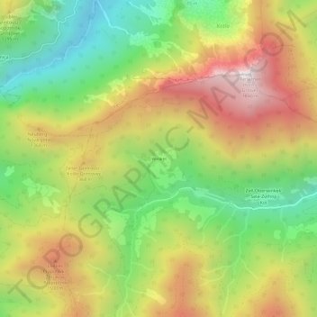
Name: Winkel topographic map, elevation, terrain.
Location: Winkel, Zell, Bezirk Klagenfurt-Land, Carinthia, 9170, Austria (46.45616 14.27779 46.49616 14.31779)
Average elevation: 1,142 m
Minimum elevation: 559 m
Maximum elevation: 1,817 m
Thank you for supporting this site ❤️
Make a donation
Make a donation
Gear up for your next adventure:
As an Amazon Associate, this site earns from qualifying purchases at no extra cost to you.