
Fóia topographic map
Interactive map
Click on the map to display elevation.
About this map
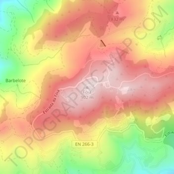
Name: Fóia topographic map, elevation, terrain.
Location: Fóia, Monchique, Faro, Algarve, 8550-218, Portugal (37.31555 -8.59649 37.31565 -8.59639)
Average elevation: 724 m
Minimum elevation: 465 m
Maximum elevation: 894 m
Other topographic maps
Click on a map to view its topography, its elevation and its terrain.
Cascata do Chilrão
Portugal > Algarve > Monchique
Cascata do Chilrão, Monchique, Faro, Algarve, 8550-218, Portugal
Average elevation: 558 m