Geolocate

Lamba topographic map

Click on the map to display elevation.

About this map

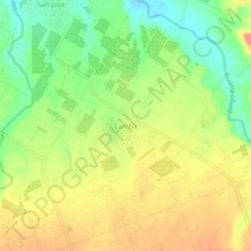
Name: Lamba topographic map, elevation, terrain.

Location: Lamba, Banga, South Cotabato, Soccsksargen, Philippines (6.33075 124.79979 6.37075 124.83979)

Average elevation: 219 m

Minimum elevation: 182 m

Maximum elevation: 255 m

Gear up for your next adventure:

🔋Solar Power Banks - Charge your phone and GPS using the sun while deep in the bush
👕UPF 50+ Sun Shirts - Essential protection against the harsh Australian sun during field work
🍴Titanium Spork & Cutlery - Indestructible and feather-light eating utensils
🕯️Emergency Whistles - Safety whistles for hiking
🕶️Polarized Sunglasses - UV protection sunglasses for outdoors

As an Amazon Associate, this site earns from qualifying purchases at no extra cost to you.