Geolocate

Berasia topographic map

Click on the map to display elevation.

About this map
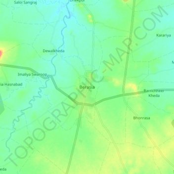
Name: Berasia topographic map, elevation, terrain.

Location: Berasia, Berasia Tahsil, Bhopal District, Madhya Pradesh, 463106, India (23.58962 77.39260 23.66962 77.47260)

Average elevation: 478 m

Minimum elevation: 457 m

Maximum elevation: 529 m

Other topographic maps

Click on a map to view its topography, its elevation and its terrain.
Bagsi

India > Madhya Pradesh > Berasia Tahsil > Bagsi

Average elevation: 458 m

Barli

India > Madhya Pradesh > Berasia Tahsil

Average elevation: 461 m

Gear up for your next adventure:

🍶Collapsible Water Bottles - Save space in your pack as you consume your water supply
📡Weather Radios - Emergency weather radios
🔥Camping Stoves - Portable stoves for outdoor cooking
🐍Snake Gaiters - Protection against snake bites
🔦Powerful LED Headlamps - Hands-free lighting for night navigation and setting up camp after dark

As an Amazon Associate, this site earns from qualifying purchases at no extra cost to you.