
São Brás de Alportel topographic map
Interactive map
Click on the map to display elevation.
About this map
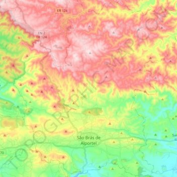
Name: São Brás de Alportel topographic map, elevation, terrain.
Location: São Brás de Alportel, Faro, Algarve, Portugal (37.12252 -7.96600 37.26877 -7.78492)
Average elevation: 322 m
Minimum elevation: 116 m
Maximum elevation: 529 m