
Tapton topographic map
Click on the map to display elevation.
About this map
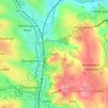
Name: Tapton topographic map, elevation, terrain.
Average elevation: 100 m
Minimum elevation: 59 m
Maximum elevation: 147 m
Other topographic maps
Click on a map to view its topography, its elevation and its terrain.
Ringwood Lake
United Kingdom > England > Derbyshire > Chesterfield > Middlecroft
Average elevation: 88 m