
Mission Ridge topographic map
Interactive map
Click on the map to display elevation.
About this map
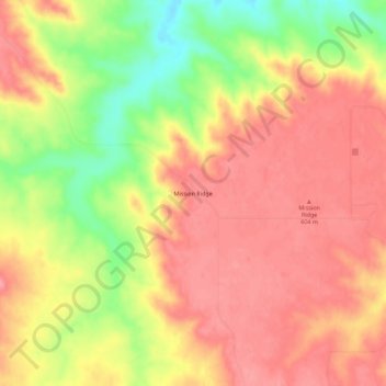
Name: Mission Ridge topographic map, elevation, terrain.
Average elevation: 580 m
Minimum elevation: 520 m
Maximum elevation: 612 m
Other topographic maps
Click on a map to view its topography, its elevation and its terrain.
Triple U Buffalo Ranch
Verenigde Staten > Zuid-Dakota > Stanley County
Triple U Buffalo Ranch, Stanley County, Zuid-Dakota, Verenigde Staten
Average elevation: 597 m
Orton
Verenigde Staten > Zuid-Dakota > Stanley County
Orton, Stanley County, Zuid-Dakota, Verenigde Staten
Average elevation: 595 m
Hayes
Verenigde Staten > Zuid-Dakota > Stanley County
Hayes, Stanley County, Zuid-Dakota, 57537, Verenigde Staten
Average elevation: 610 m