
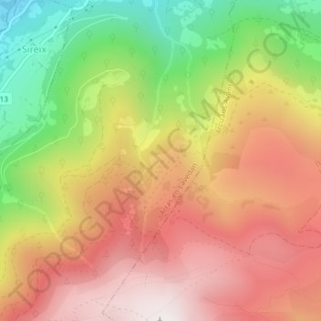
Saint-Martin topographic map
Interactive map
Click on the map to display elevation.
About this map
Name: Saint-Martin topographic map, elevation, terrain.
Average elevation: 1,262 m
Minimum elevation: 676 m
Maximum elevation: 1,734 m
Other topographic maps
Click on a map to view its topography, its elevation and its terrain.
Las Horgues
France > Occitanie > Hautes-Pyrénées > Arras-en-Lavedan
Las Horgues, Arras-en-Lavedan, Argelès-Gazost, Hautes-Pyrénées, Occitanie, France métropolitaine, 65400, France
Average elevation: 1,185 m
Hontède
France > Occitanie > Hautes-Pyrénées > Arras-en-Lavedan
Hontède, Arras-en-Lavedan, Argelès-Gazost, Hautes-Pyrénées, Occitanie, France métropolitaine, 65400, France
Average elevation: 999 m