
Torridge topographic map
Interactive map
Click on the map to display elevation.
About this map
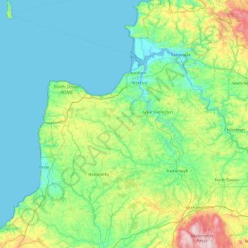
Name: Torridge topographic map, elevation, terrain.
Location: Torridge, Devon, South West England, England, United Kingdom (50.64645 -4.68066 51.20253 -3.88382)
Average elevation: 113 m
Minimum elevation: 0 m
Maximum elevation: 612 m
Other topographic maps
Click on a map to view its topography, its elevation and its terrain.
Lundy
United Kingdom > England > Torridge
Lundy, Torridge, Devon, South West England, England, EX39 2LY, United Kingdom
Average elevation: 16 m