
Thank you for supporting this site ❤️
Make a donation
Make a donation
Gear up for your next adventure:
As an Amazon Associate, this site earns from qualifying purchases at no extra cost to you.
Bambalamotu topographic map
Click on the map to display elevation.
Thank you for supporting this site ❤️
Make a donation
Make a donation
Gear up for your next adventure:
As an Amazon Associate, this site earns from qualifying purchases at no extra cost to you.
About this map
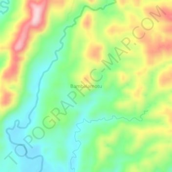
Name: Bambalamotu topographic map, elevation, terrain.
Location: Bambalamotu, Pasangkayu, West Sulawesi, Sulawesi, Indonesia (-1.18030 119.49201 -1.14030 119.53201)
Average elevation: 158 m
Minimum elevation: 42 m
Maximum elevation: 334 m
Thank you for supporting this site ❤️
Make a donation
Make a donation
Gear up for your next adventure:
As an Amazon Associate, this site earns from qualifying purchases at no extra cost to you.