
Plaza de Armas topographic map
Interactive map
Click on the map to display elevation.
About this map
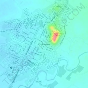
Name: Plaza de Armas topographic map, elevation, terrain.
Location: Plaza de Armas, Chulucanas, Morropón, Piura, Perú (-5.09689 -80.16123 -5.09610 -80.16063)
Average elevation: 94 m
Minimum elevation: 82 m
Maximum elevation: 166 m
Other topographic maps
Click on a map to view its topography, its elevation and its terrain.
Río Seco Bajo
Perú > Piura > Chulucanas
Río Seco Bajo, Chulucanas, Morropón, Piura, Perú
Average elevation: 117 m
Km. 50
Perú > Piura > Chulucanas > Km. 50
Km. 50, Chulucanas, Morropón, Piura, Perú
Average elevation: 119 m