Geolocate

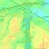
Landmarks topographic map

Click on the map to display elevation.

About this map

Name: Landmarks topographic map, elevation, terrain.

Location: Landmarks, Montgomery, Montgomery County, Alabama, 36119, United States (32.35847 -86.21441 32.39847 -86.17441)

Average elevation: 72 m

Minimum elevation: 49 m

Maximum elevation: 92 m

Other topographic maps

Click on a map to view its topography, its elevation and its terrain.
Gear up for your next adventure:

🧥Softshell Jackets - Flexible outdoor jackets
⌚GPS Watches - GPS watches for outdoor sports
🧺Waterproof Dry Sacks - Organize your pack and keep electronics safe from rain and river crossings
🧼Biodegradable Outdoor Soap - Clean gear and yourself without harming the local ecosystem
🧥Packable Rain Jackets - Breathable waterproof layers for unpredictable mountain weather

As an Amazon Associate, this site earns from qualifying purchases at no extra cost to you.