Geolocate

Midwest topographic map

Click on the map to display elevation.

About this map
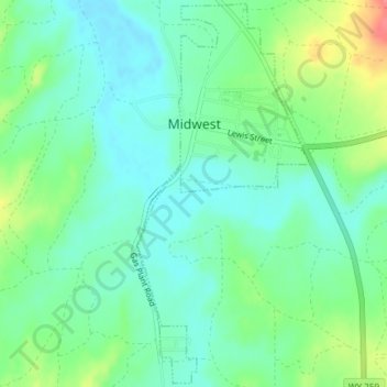
Name: Midwest topographic map, elevation, terrain.

Location: Midwest, Natrona County, Wyoming, United States (43.39323 -106.28563 43.41977 -106.26896)

Average elevation: 1,482 m

Minimum elevation: 1,461 m

Maximum elevation: 1,530 m

Other topographic maps

Click on a map to view its topography, its elevation and its terrain.
Casper

United States > Wyoming > Natrona County

Average elevation: 1,635 m

Gear up for your next adventure:

🍶Collapsible Water Bottles - Save space in your pack as you consume your water supply
📡Weather Radios - Emergency weather radios
🪫Rechargeable Headlamps - USB rechargeable headlamps
📸Action Cameras - Record your journey across interesting topographic features in 4K
🧼Biodegradable Outdoor Soap - Clean gear and yourself without harming the local ecosystem

As an Amazon Associate, this site earns from qualifying purchases at no extra cost to you.