Geolocate

Ishpatina Ridge topographic map

Click on the map to display elevation.

About this map
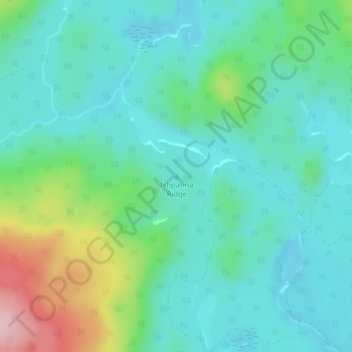
Name: Ishpatina Ridge topographic map, elevation, terrain.

Location: Ishpatina Ridge, Unorganized West Timiskaming, Timiskaming District, Northeastern Ontario, Ontario, Canada (47.35341 -80.69652 47.35351 -80.69642)

Average elevation: 429 m

Minimum elevation: 375 m

Maximum elevation: 600 m

Other topographic maps

Click on a map to view its topography, its elevation and its terrain.
Gear up for your next adventure:

☕Outdoor Coffee Makers - Enjoy quality coffee at the summit of your favorite peak
🥶Thermal Beanies - Warm hats for cold hikes
🧴SPF 50+ Bulk Sunscreen - Maximum protection for long-term outdoor exposure
🩹Blister Prevention Tape - Apply to friction points before they become painful sores
📕Australia Maps - Maps covering Australian regions

As an Amazon Associate, this site earns from qualifying purchases at no extra cost to you.