Geolocate

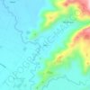
Assumption topographic map

Click on the map to display elevation.

About this map

Name: Assumption topographic map, elevation, terrain.

Location: Assumption, Koronadal, South Cotabato, Soccsksargen, Philippines (6.35177 124.81203 6.46425 124.87037)

Average elevation: 267 m

Minimum elevation: 70 m

Maximum elevation: 808 m

Other topographic maps

Click on a map to view its topography, its elevation and its terrain.
Quezon Range

Philippines > South Cotabato > Koronadal

Average elevation: 239 m

Quezon Range

Philippines > South Cotabato > Koronadal

Average elevation: 239 m

Siok

Philippines > South Cotabato > Koronadal > Mabini

Average elevation: 131 m

Gear up for your next adventure:

🧊Insulated Stainless Steel Flasks - Keep water cold for 24 hours in the heat or coffee hot in the cold
👄SPF Lip Balm - Prevent sun and wind-burnt lips on mountain ridges
🎒Ultralight Backpacks - Lightweight packs for long hikes
🔦Powerful LED Headlamps - Hands-free lighting for night navigation and setting up camp after dark
💡Collapsible Camping Lanterns - Illuminate your base camp or tent for map studying at night

As an Amazon Associate, this site earns from qualifying purchases at no extra cost to you.