Geolocate

Betteng topographic map

Click on the map to display elevation.

About this map

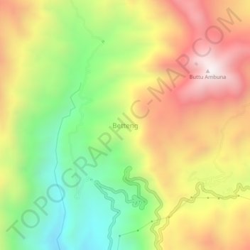
Name: Betteng topographic map, elevation, terrain.

Location: Betteng, Pinrang, South Sulawesi, Sulawesi, Indonesia (-3.44621 119.52859 -3.40621 119.56859)

Average elevation: 757 m

Minimum elevation: 207 m

Maximum elevation: 1,343 m

Other topographic maps

Click on a map to view its topography, its elevation and its terrain.

Gear up for your next adventure:

🏃Compression Recovery Socks - Reduce leg fatigue after heavy days of elevation gain
🔦Powerful LED Headlamps - Hands-free lighting for night navigation and setting up camp after dark
🎒Tactical Waist Packs - Quick access to your compass, phone, and snacks while walking
🖼️Scratch-off Australia Map - Track the regions and peaks you have explored geographically
🧼Biodegradable Outdoor Soap - Clean gear and yourself without harming the local ecosystem

As an Amazon Associate, this site earns from qualifying purchases at no extra cost to you.