
Thank you for supporting this site ❤️
Make a donation
Make a donation
Gear up for your next adventure:
As an Amazon Associate, this site earns from qualifying purchases at no extra cost to you.
Sudbury topographic map
Click on the map to display elevation.
Thank you for supporting this site ❤️
Make a donation
Make a donation
Gear up for your next adventure:
As an Amazon Associate, this site earns from qualifying purchases at no extra cost to you.
About this map
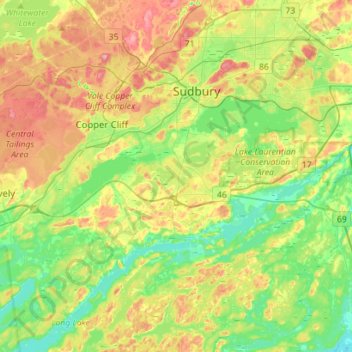
Name: Sudbury topographic map, elevation, terrain.
Location: Sudbury, Greater Sudbury, Sudbury District, Ontario, Canada (46.34876 -81.08529 46.54273 -80.87967)
Average elevation: 272 m
Minimum elevation: 219 m
Maximum elevation: 351 m
Thank you for supporting this site ❤️
Make a donation
Make a donation
Gear up for your next adventure:
As an Amazon Associate, this site earns from qualifying purchases at no extra cost to you.