
Lowlands topographic map
Interactive map
Click on the map to display elevation.
About this map
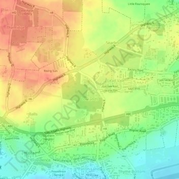
Name: Lowlands topographic map, elevation, terrain.
Location: Lowlands, Christ Church, Barbados (13.07973 -59.52497 13.08996 -59.50750)
Average elevation: 84 m
Minimum elevation: 51 m
Maximum elevation: 108 m
Other topographic maps
Click on a map to view its topography, its elevation and its terrain.