
Nimer topographic map
Interactive map
Click on the map to display elevation.
About this map
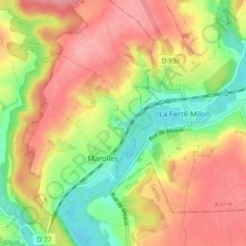
Name: Nimer topographic map, elevation, terrain.
Average elevation: 108 m
Minimum elevation: 58 m
Maximum elevation: 151 m
Other topographic maps
Click on a map to view its topography, its elevation and its terrain.
Marolles
France > Hauts-de-France > Oise > Marolles
Marolles, Senlis, Oise, Hauts-de-France, France métropolitaine, 60890, France
Average elevation: 110 m