
Thank you for supporting this site ❤️
Make a donation
Make a donation
Gear up for your next adventure:
As an Amazon Associate, this site earns from qualifying purchases at no extra cost to you.
Guanyang topographic map
Click on the map to display elevation.
Thank you for supporting this site ❤️
Make a donation
Make a donation
Gear up for your next adventure:
As an Amazon Associate, this site earns from qualifying purchases at no extra cost to you.
About this map
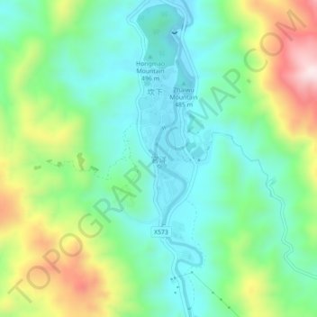
Name: Guanyang topographic map, elevation, terrain.
Location: Guanyang, Nanjing County, Zhangzhou City, Fujian, China (24.64473 117.06869 24.68473 117.10869)
Average elevation: 589 m
Minimum elevation: 429 m
Maximum elevation: 942 m
Thank you for supporting this site ❤️
Make a donation
Make a donation
Gear up for your next adventure:
As an Amazon Associate, this site earns from qualifying purchases at no extra cost to you.