
Prestbury topographic map
Interactive map
Click on the map to display elevation.
About this map
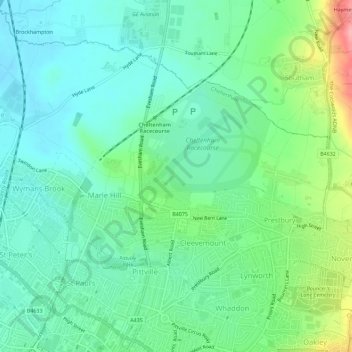
Name: Prestbury topographic map, elevation, terrain.
Average elevation: 63 m
Minimum elevation: 32 m
Maximum elevation: 145 m
Other topographic maps
Click on a map to view its topography, its elevation and its terrain.
Prestbury
United Kingdom > England > Gloucestershire > Cheltenham
Prestbury, Cheltenham, Gloucestershire, England, GL52 3EL, United Kingdom
Average elevation: 110 m