Geolocate

Halol topographic map

Click on the map to display elevation.

About this map

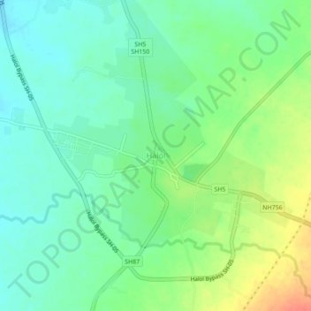
Name: Halol topographic map, elevation, terrain.

Location: Halol, Halol Taluka, Panchmahal, Gujarat, 389350, India (22.48585 73.45159 22.52585 73.49159)

Average elevation: 107 m

Minimum elevation: 89 m

Maximum elevation: 138 m

Gear up for your next adventure:

🪢550 Survival Paracord - Versatile cordage for gear repair and emergency lashing
GPS Watches - GPS watches for outdoor sports
🔋Rechargeable Batteries - Eco-friendly power for high-drain GPS units and flashlights
🎒40L Day Hiking Backpacks - Comfortable packs with hydration support for long days exploring topographic peaks
🧊Insulated Stainless Steel Flasks - Keep water cold for 24 hours in the heat or coffee hot in the cold

As an Amazon Associate, this site earns from qualifying purchases at no extra cost to you.