
Borriol topographic map
Interactive map
Click on the map to display elevation.
About this map
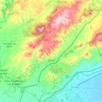
Name: Borriol topographic map, elevation, terrain.
Location: Borriol, Plana Alta, Castellón, Comunidad Valenciana, España (40.00941 -0.15796 40.09739 0.00228)
Average elevation: 250 m
Minimum elevation: -1 m
Maximum elevation: 724 m