
Wallace Lake topographic map
Interactive map
Click on the map to display elevation.
About this map
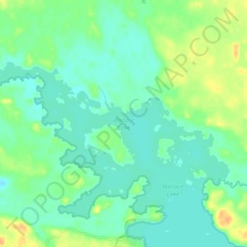
Name: Wallace Lake topographic map, elevation, terrain.
Location: Wallace Lake, Provincial Road 304, Manitoba, Canada (51.01312 -95.40560 51.03925 -95.32279)
Average elevation: 314 m
Minimum elevation: 304 m
Maximum elevation: 332 m
Other topographic maps
Click on a map to view its topography, its elevation and its terrain.
Goulbourne
Canada > Manitoba > Division No. 18 > Municipality of West Interlake
Average elevation: 251 m