
Thank you for supporting this site ❤️
Make a donation
Make a donation
Gear up for your next adventure:
As an Amazon Associate, this site earns from qualifying purchases at no extra cost to you.
Acobamba topographic map
Click on the map to display elevation.
Thank you for supporting this site ❤️
Make a donation
Make a donation
Gear up for your next adventure:
As an Amazon Associate, this site earns from qualifying purchases at no extra cost to you.
About this map
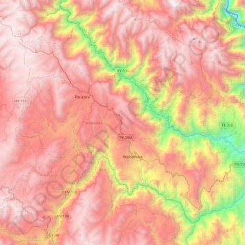
Name: Acobamba topographic map, elevation, terrain.
Location: Acobamba, Huancavelica, 09380, Perú (-12.96686 -74.79570 -12.58986 -74.32212)
Average elevation: 3,622 m
Minimum elevation: 1,992 m
Maximum elevation: 4,641 m
Thank you for supporting this site ❤️
Make a donation
Make a donation
Gear up for your next adventure:
As an Amazon Associate, this site earns from qualifying purchases at no extra cost to you.