
Rute topographic map
Interactive map
Click on the map to display elevation.
About this map
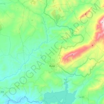
Name: Rute topographic map, elevation, terrain.
Location: Rute, Córdoba, Andalusien, Spanien (37.27246 -4.42834 37.41688 -4.27776)
Average elevation: 605 m
Minimum elevation: 315 m
Maximum elevation: 1,463 m