
Grindavík topographic map
Interactive map
Click on the map to display elevation.
About this map
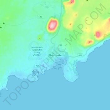
Name: Grindavík topographic map, elevation, terrain.
Location: Grindavík, Grindavíkurbær, Southern Peninsula, 240, Iceland (63.80424 -22.47175 63.88424 -22.39175)
Average elevation: 27 m
Minimum elevation: -10 m
Maximum elevation: 221 m