
Gratal topographic map
Interactive map
Click on the map to display elevation.
About this map
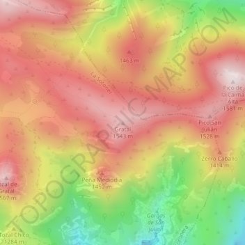
Name: Gratal topographic map, elevation, terrain.
Average elevation: 1,309 m
Minimum elevation: 929 m
Maximum elevation: 1,570 m
Other topographic maps
Click on a map to view its topography, its elevation and its terrain.
La Sotonera
España > Aragón > La Sotonera
La Sotonera, Hoya de Huesca, Huesca, Aragón, España
Average elevation: 692 m