
Valley End topographic map
Click on the map to display elevation.
About this map
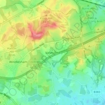
Name: Valley End topographic map, elevation, terrain.
Average elevation: 56 m
Minimum elevation: 28 m
Maximum elevation: 99 m
Other topographic maps
Click on a map to view its topography, its elevation and its terrain.
Bagshot Park Mansion
United Kingdom > England > Surrey > Surrey Heath > Bagshot
Average elevation: 76 m
Chobham Common
United Kingdom > England > Surrey > Surrey Heath > Chobham > Brick Hill
Average elevation: 49 m
Frimley Lodge Park
United Kingdom > England > Surrey > Surrey Heath > Frimley Green
Average elevation: 80 m
Chobham
United Kingdom > England > Surrey > Surrey Heath
The rolling basin below reaches lowest elevations of between 30 metres (98 ft) in the centre of the west and 20 metres (66 ft) where the rivers join in the centre of the east. The rivers at the western point are less than 100 metres (330 ft) apart; to the east end of the parish where the parish adjoins the…
Average elevation: 43 m