
Setor Industrial topographic map
Interactive map
Click on the map to display elevation.
About this map
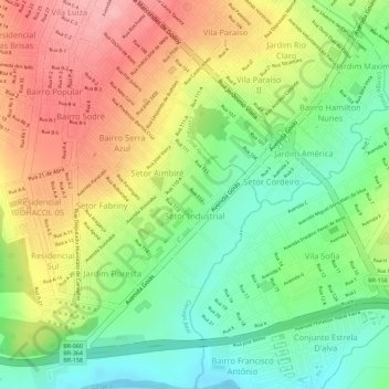
Name: Setor Industrial topographic map, elevation, terrain.
Average elevation: 670 m
Minimum elevation: 604 m
Maximum elevation: 739 m
Other topographic maps
Click on a map to view its topography, its elevation and its terrain.
Recanto da Mata
Recanto da Mata, Jataí, Região Geográfica Imediata de Jataí-Mineiros, Região Geográfica Intermediária de Rio Verde, Goiás, Região Centro-Oeste, Brasil
Average elevation: 768 m
Setor Jardim Goiás II
Setor Jardim Goiás II, Jataí, Região Geográfica Imediata de Jataí-Mineiros, Região Geográfica Intermediária de Rio Verde, Goiás, Região Centro-Oeste, Brasil
Average elevation: 787 m
Naveslândia
Brasil > Goiás > Jataí > Naveslândia
Naveslândia, Jataí, Microrregião Sudoeste de Goiás, Região Geográfica Intermediária de Rio Verde, Goiás, Região Centro-Oeste, Brasil
Average elevation: 688 m