
Wahrburg topographic map
Interactive map
Click on the map to display elevation.
About this map
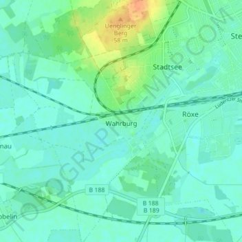
Name: Wahrburg topographic map, elevation, terrain.
Location: Wahrburg, Stendal, Sachsen-Anhalt, Deutschland (52.56934 11.79332 52.61119 11.83640)
Average elevation: 38 m
Minimum elevation: 29 m
Maximum elevation: 64 m
Other topographic maps
Click on a map to view its topography, its elevation and its terrain.
Vinzelberg
Deutschland > Sachsen-Anhalt > Stendal
Vinzelberg, Stendal, Sachsen-Anhalt, Deutschland
Average elevation: 54 m
Uchtspringe
Deutschland > Sachsen-Anhalt > Stendal > Uchtspringe
Uchtspringe, Stendal, Sachsen-Anhalt, Deutschland
Average elevation: 84 m
Wittenmoor
Deutschland > Sachsen-Anhalt > Stendal
Wittenmoor, Stendal, Sachsen-Anhalt, Deutschland
Average elevation: 65 m
Heeren
Deutschland > Sachsen-Anhalt > Stendal > Heeren
Heeren, Stendal, Sachsen-Anhalt, Deutschland
Average elevation: 41 m