
Thank you for supporting this site ❤️
Make a donation
Make a donation
Gear up for your next adventure:
As an Amazon Associate, this site earns from qualifying purchases at no extra cost to you.
Pussey topographic map
Click on the map to display elevation.
Thank you for supporting this site ❤️
Make a donation
Make a donation
Gear up for your next adventure:
As an Amazon Associate, this site earns from qualifying purchases at no extra cost to you.
About this map
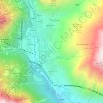
Name: Pussey topographic map, elevation, terrain.
Location: Pussey, Courmayeur, Aosta Valley, 11013, Italy (45.76716 6.95701 45.80716 6.99701)
Average elevation: 1,561 m
Minimum elevation: 1,022 m
Maximum elevation: 2,521 m
Thank you for supporting this site ❤️
Make a donation
Make a donation
Gear up for your next adventure:
As an Amazon Associate, this site earns from qualifying purchases at no extra cost to you.