
Make a donation
Gear up for your next adventure:
As an Amazon Associate, this site earns from qualifying purchases at no extra cost to you.
Retteri Lake topographic map
Click on the map to display elevation.
Make a donation
Gear up for your next adventure:
As an Amazon Associate, this site earns from qualifying purchases at no extra cost to you.
About this map
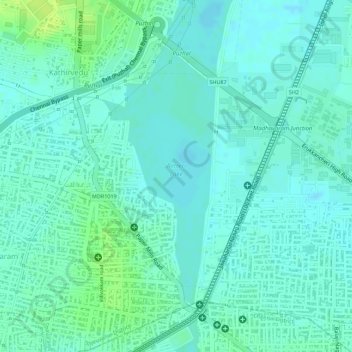
Name: Retteri Lake topographic map, elevation, terrain.
Average elevation: 10 m
Minimum elevation: 4 m
Maximum elevation: 19 m
Make a donation
Gear up for your next adventure:
As an Amazon Associate, this site earns from qualifying purchases at no extra cost to you.
Other topographic maps
Click on a map to view its topography, its elevation and its terrain.
Zone 3 Madhavaram
India > Tamil Nadu > Mathavaram > Chennai
Madhavaram is located at 13°09′N 80°14′E / 13.15°N 80.24°E / 13.15; 80.24. It has an average elevation of 13 metres (42 feet).
Average elevation: 8 m
Make a donation
Gear up for your next adventure:
As an Amazon Associate, this site earns from qualifying purchases at no extra cost to you.