Geolocate

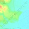
Bone Branch topographic map

Click on the map to display elevation.

About this map

Name: Bone Branch topographic map, elevation, terrain.

Location: Bone Branch, Falls County, Texas, United States (31.21445 -97.06204 31.23841 -97.04501)

Average elevation: 147 m

Minimum elevation: 129 m

Maximum elevation: 167 m

Other topographic maps

Click on a map to view its topography, its elevation and its terrain.

Marlin

United States > Texas > Falls County

Average elevation: 119 m

Satin

United States > Texas > Falls County

Average elevation: 115 m

Rosebud

United States > Texas > Falls County

Average elevation: 124 m

Marlin

United States > Texas > Falls County

Average elevation: 119 m

Marlin

United States > Texas > Falls County

Average elevation: 119 m

Gear up for your next adventure:

👄SPF Lip Balm - Prevent sun and wind-burnt lips on mountain ridges
🛠️Outdoor Repair Kits - Gear repair kits
🎨Portable Watercolor Kits - Paint the landscapes and topographic views you discover
⌚GPS Watches - GPS watches for outdoor sports
📚Map Reading & Navigation Guides - Master the art of interpreting topographic contours and symbols

As an Amazon Associate, this site earns from qualifying purchases at no extra cost to you.