
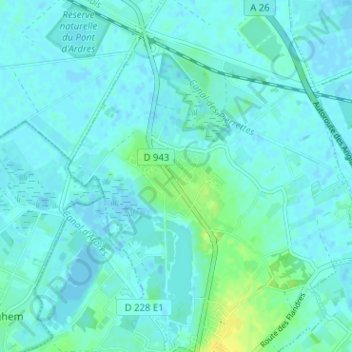
Bois-en-Ardres topographic map
Interactive map
Click on the map to display elevation.
About this map
Name: Bois-en-Ardres topographic map, elevation, terrain.
Average elevation: 4 m
Minimum elevation: -2 m
Maximum elevation: 18 m
Other topographic maps
Click on a map to view its topography, its elevation and its terrain.
Les Pèlerins
France > Hauts-de-France > Pas-de-Calais > Ardres
Les Pèlerins, Ardres, Calais, Pas-de-Calais, Hauts-de-France, France métropolitaine, 62610, France
Average elevation: 10 m