
Izumisano topographic map
Interactive map
Click on the map to display elevation.
About this map
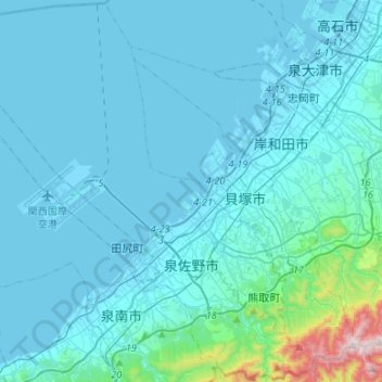
Name: Izumisano topographic map, elevation, terrain.
Location: Izumisano, Osaka Prefecture, Japan (34.32844 135.14373 34.54423 135.40922)
Average elevation: 64 m
Minimum elevation: -8 m
Maximum elevation: 847 m