
Lohnsberg topographic map
Interactive map
Click on the map to display elevation.
About this map
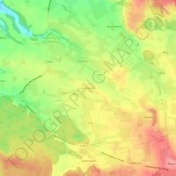
Name: Lohnsberg topographic map, elevation, terrain.
Average elevation: 480 m
Minimum elevation: 429 m
Maximum elevation: 521 m
Other topographic maps
Click on a map to view its topography, its elevation and its terrain.
Reith
Österreich > Oberösterreich > Bezirk Braunau am Inn > Gilgenberg am Weilhart
Reith, Gilgenberg am Weilhart, Bezirk Braunau am Inn, Oberösterreich, 5133, Österreich
Average elevation: 448 m