Geolocate

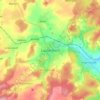
Bieben topographic map

Click on the map to display elevation.

About this map

Name: Bieben topographic map, elevation, terrain.

Location: Bieben, Grebenau, Vogelsbergkreis, Hesse, Germany (50.74468 9.41280 50.76970 9.46668)

Average elevation: 366 m

Minimum elevation: 277 m

Maximum elevation: 494 m

Other topographic maps

Click on a map to view its topography, its elevation and its terrain.

Schmitten

Germany > Hesse > Vogelsbergkreis > Sellnrod

Average elevation: 383 m

Dick

Germany > Hesse > Vogelsbergkreis

Average elevation: 378 m

Lauterbach

Germany > Hesse > Vogelsbergkreis

Average elevation: 361 m

Gear up for your next adventure:

🦟Insect Repellent - Protection against insects
🐍Snake Gaiters - Protection against snake bites
🥤Hydration Packs - Hydration systems for hiking
🆘Personal Locator Beacons (PLB) - Satellite emergency beacons for life-saving help in areas with no mobile coverage
🥾Heavy Duty Hiking Boots - Ankle-supporting boots for carrying heavy packs on steep contours

As an Amazon Associate, this site earns from qualifying purchases at no extra cost to you.