Geolocate

Kionsom topographic map

Click on the map to display elevation.

About this map

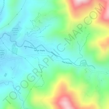
Name: Kionsom topographic map, elevation, terrain.

Location: Kionsom, Kota Kinabalu District, Sabah, Malaysia (5.97688 116.17406 5.98375 116.19393)

Average elevation: 146 m

Minimum elevation: 18 m

Maximum elevation: 422 m

Gear up for your next adventure:

📍Handheld GPS - GPS devices for hiking and navigation
🧥Packable Rain Jackets - Breathable waterproof layers for unpredictable mountain weather
🗺️Topographic Maps - Detailed maps for hiking and navigation
🐍Snake Gaiters - Protection against snake bites
📦Crushproof Equipment Cases - Safe transport for sensitive surveying and mapping instruments

As an Amazon Associate, this site earns from qualifying purchases at no extra cost to you.